
Mexico State
It is the most populous county, as well as the most heavily inhabited.
🌍 Part of the My Guide Network
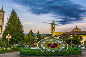
The State of Mexico is sometimes abbreviated in Spanish from the State of Mexico to Edomex, in order to differentiate it from the name of the whole country. It is the most populous county, as well as the most heavily inhabited. Toluca de Lerdo is the capital city.
It's located in the south of central Mexico. It borders the states of Querétaro and Hidalgo to the north, Morelos and Guerrero to the south, Michoacán to the west, Tlaxcala and Puebla to the east and covers Mexico City (former Federal District) on three sides.
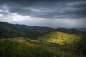
The state is split into five geographical regions: the volcanoes of the Valley of Mexico, the hills and plains of the north of the state, the western ranges, the Balsa depression, and the mountains and valleys of the south-east.
Approximately seventy percent of the state has a temperate tropical climate consisting of the highlands of the Toluca Valley and the areas around Texcoco in the north, the Toluca Valley, and the areas around Texcoco. Real year-round temperatures range between 12C and 22C.
The foundations of the state lay in the territories of the Aztec Empire, which remained the political division of New Spain throughout the Spanish colonial era. After being autonomous, Mexico City was selected as the capital of the new nation; its territory was divided from the state. Years later, portions of the state were split up to create the states of Hidalgo, Guerrero, and Morelos.
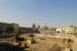
Primary archaeological sites include Teotihuacan, Malinalco, Teotenango, and Calixtlahuaca. The most popular and most important of these is the huge Mesoamerican Teotihuacan, with thousands of visitors per year. This city predates the Aztecs and the Toltecs and is marked by two great pyramids, the Pyramid of the Sun and the Pyramid of the Moon.
Many of the colonial attractions of the state are marketed by the scheme "Pueblos con Encanto". These include monasteries and churches in cities such as Acolman, Aculco, Amanalco, Amecameca, Ayapango, El Oro, Ixtapan de la Sal, Malinalco, Metepec, Otumba, Temascalcingo, San Juan Teotihuacán, Tlalmanalco, Tonatico and Villa del Carbón.
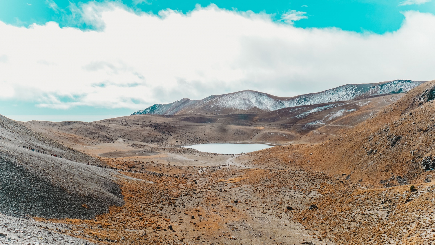
The geological phenomenon most closely identified with the state is the Nevado de Toluca or the Xinantécatl volcano situated just south of the capital of Toluca. It is an extinct volcano that rises 4.690 meters above sea level, making it the fourth highest peak in Mexico. At the top is a very wide crater with two lakes called Laguna del Sol and Laguna de la Luna. The volcano and its surroundings are part of the Nevado de Toluca National Park and the Los Venado National Park.
The most traditional handcrafted products are made in areas such as Metepec, Valle de Bravo, Texcoco, and Almoloya de Juárez, among others. The best-known local pottery and ceramics is Metepec, which specializes in large decorative items and sculptures called Trees of Life. The cooking utensils are also made.
Cultural dances performed throughout the country include Danza de los Concheros, Danza de Moros y Cristianos, Doce Pares de Francia, Morisma and Santiagos. The El Tzimare-cu, which is done by the Otomi groups in Xonacatlán, Villa Cuauhtemoc and Temoaya, is a special state of Mexico.
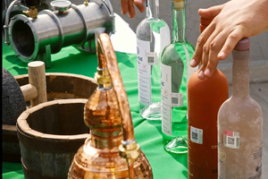
Rich indigenous culture and varied ecosystems (from desert to pine forest) make the Estado de México a culinary melting pot. Easy delights such as tlacoyos (blue cornmeal "pockets" filled with bean paste and cooked on a comal or griddle) are popular and served in a variety of ways.
It's located in the south of central Mexico. It borders the states of Querétaro and Hidalgo to the north, Morelos and Guerrero to the south, Michoacán to the west, Tlaxcala and Puebla to the east and covers Mexico City (former Federal District) on three sides.
The state is split into five geographical regions: the volcanoes of the Valley of Mexico, the hills and plains of the north of the state, the western ranges, the Balsa depression, and the mountains and valleys of the south-east.
Approximately seventy percent of the state has a temperate tropical climate consisting of the highlands of the Toluca Valley and the areas around Texcoco in the north, the Toluca Valley, and the areas around Texcoco. Real year-round temperatures range between 12C and 22C.
The foundations of the state lay in the territories of the Aztec Empire, which remained the political division of New Spain throughout the Spanish colonial era. After being autonomous, Mexico City was selected as the capital of the new nation; its territory was divided from the state. Years later, portions of the state were split up to create the states of Hidalgo, Guerrero, and Morelos.
Primary archaeological sites include Teotihuacan, Malinalco, Teotenango, and Calixtlahuaca. The most popular and most important of these is the huge Mesoamerican Teotihuacan, with thousands of visitors per year. This city predates the Aztecs and the Toltecs and is marked by two great pyramids, the Pyramid of the Sun and the Pyramid of the Moon.
Many of the colonial attractions of the state are marketed by the scheme "Pueblos con Encanto". These include monasteries and churches in cities such as Acolman, Aculco, Amanalco, Amecameca, Ayapango, El Oro, Ixtapan de la Sal, Malinalco, Metepec, Otumba, Temascalcingo, San Juan Teotihuacán, Tlalmanalco, Tonatico and Villa del Carbón.
The geological phenomenon most closely identified with the state is the Nevado de Toluca or the Xinantécatl volcano situated just south of the capital of Toluca. It is an extinct volcano that rises 4.690 meters above sea level, making it the fourth highest peak in Mexico. At the top is a very wide crater with two lakes called Laguna del Sol and Laguna de la Luna. The volcano and its surroundings are part of the Nevado de Toluca National Park and the Los Venado National Park.
The most traditional handcrafted products are made in areas such as Metepec, Valle de Bravo, Texcoco, and Almoloya de Juárez, among others. The best-known local pottery and ceramics is Metepec, which specializes in large decorative items and sculptures called Trees of Life. The cooking utensils are also made.
Cultural dances performed throughout the country include Danza de los Concheros, Danza de Moros y Cristianos, Doce Pares de Francia, Morisma and Santiagos. The El Tzimare-cu, which is done by the Otomi groups in Xonacatlán, Villa Cuauhtemoc and Temoaya, is a special state of Mexico.
Rich indigenous culture and varied ecosystems (from desert to pine forest) make the Estado de México a culinary melting pot. Easy delights such as tlacoyos (blue cornmeal "pockets" filled with bean paste and cooked on a comal or griddle) are popular and served in a variety of ways.
By REPOST

